
Snow-Packed North – investigating snow that feeds an entire country
The Himalaya-Karakoram-Hindukush (HKH) mountain ranges from the northern front of high mountains in the Upper Indus Basin of Pakistan. There is little knowledge regarding the seasonal snow that falls on land and on ice across the HKH mountains. A significant amount of river discharge in the region originates from seasonal snowmelt. However, contemporary research to investigate the freshwater sources has predominantly been confined to glaciers as opposed to highly dynamic seasonal snow in big and small catchments across the HKH. Considering the role of freshwater from these rivers in the regional agriculture, economy, and potential hazards, it is important that the seasonal snow climatology be analysed, especially under the influence of climate change.
Several studies have attempted to study regional glaciers and snow via modelling, data assimilation and satellite retrievals. However, in-situ (ground collected) data is necessary for calibration and evaluation purposes. Lack of in-situ data has limited the validation of modelled estimates and satellite-based retrievals. While government agencies like WAPDA and Pakistan Meteorology department, and NGOs such as the Aga Khan Agency for Habitat have been collecting snow depth data at several locations in northern Pakistan, there is no record of snowpack characteristics (such as snow density, snow grain size, and snow temperature) or the dominant processes that control the snowpack formation and decay.
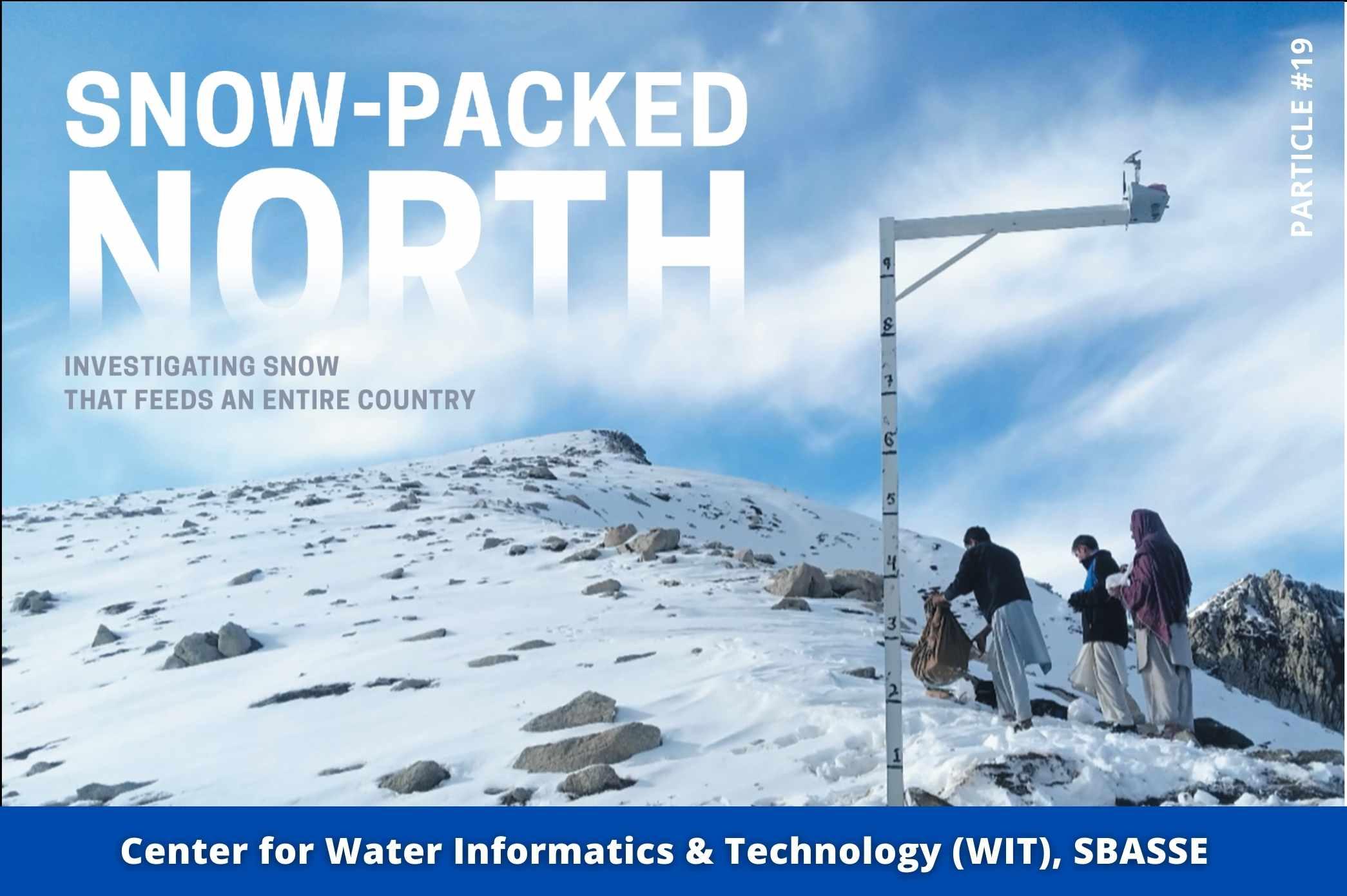
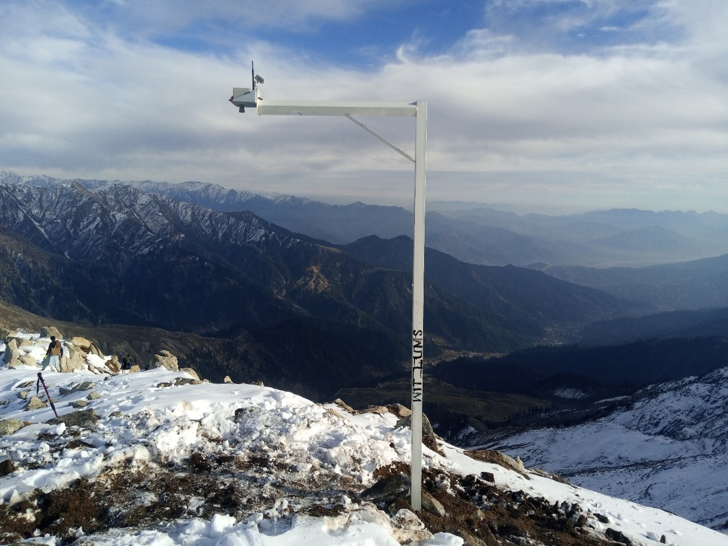
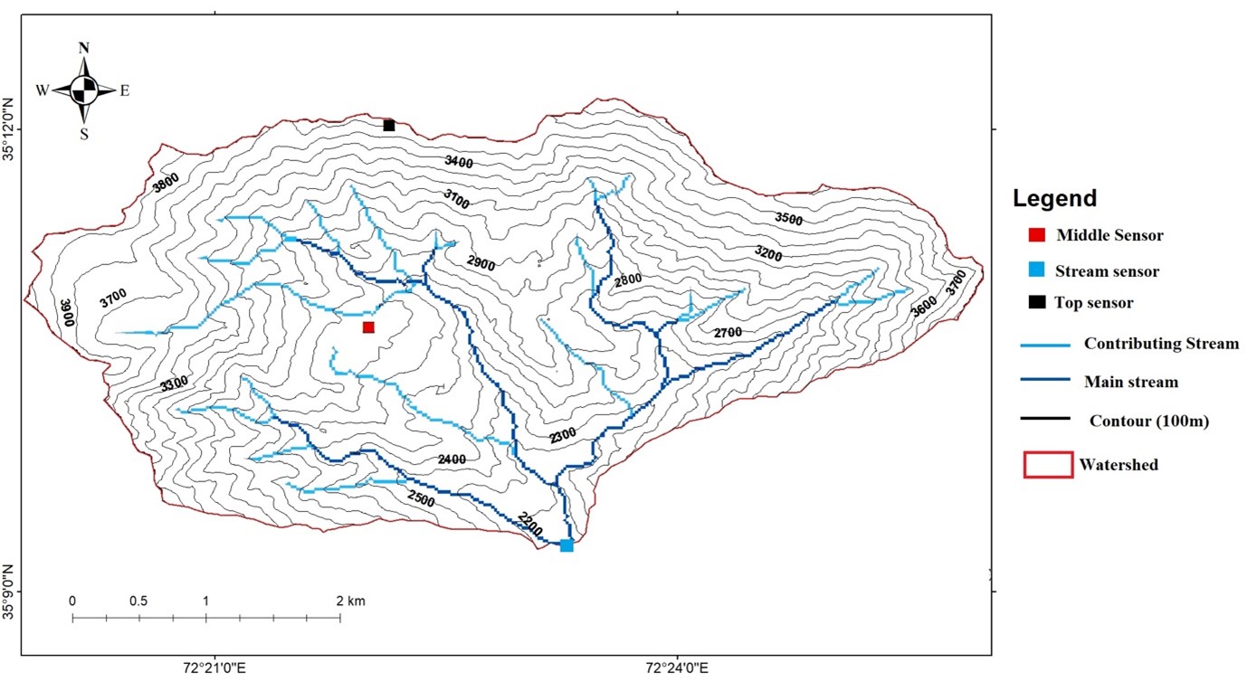
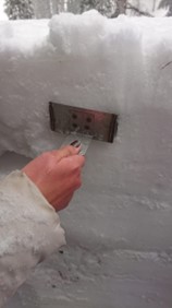
The Centre for Water Informatics and Technology (WIT) at LUMS is determined to fill this gap in the current understanding of seasonal snow characteristics across northern Pakistan. WIT has installed telemetry-based sensors to measure snow depth in a snow-dominated catchment (Gabin Jabba, Swat). Moreover, WIT researchers are using state-of-the-art computational methods to fuse the ground-based data with satellite-based remote sensing estimates in various catchments of the HKH.
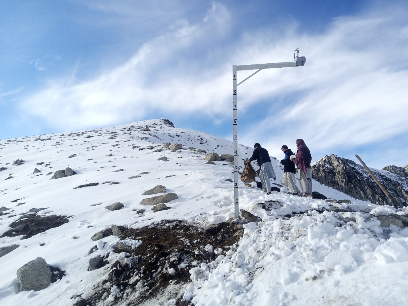
These indigenously developed sensors have measured snow depth and runoff at several locations within a catchment in the Swat district for the past three years. In order to convert the snow depth measurements into snow water equivalent, information about snow density is required.
Snow water equivalent estimates are an important part of an ongoing water balance study across this catchment. Therefore, WIT has been busy with computing the regional water balance, especially as pertains to snowmelt and runoff. This information is useful in forecasting floods/droughts and water scarcity indicators. In addition, regional initiatives such as the NASA High Mountain Asia Team (HiMAT) projects will also find the in-situ measured data useful for model and satellite-retrieval validation purposes.
Genesis of the Project
A culture that invites curiosity, encourages exploration, and empowers scientists and engineers of SSE to challenge and test themselves is vital to fostering innovation. Mr. Zahoor Ahmad, a Research Engineer at WIT, and with an MS in electrical engineering at LUMS, came up with the idea to use ultrasonic level measuring technology for snow level measurement, which led to a whole research domain at the center.
Mr. Zahoor, a native of Swat, was well aware of the impact of climate change on the communities in mountainous regions. He came up with the idea of reconfiguring WIT’s digital canal gauge technology, originally developed for monitoring irrigation canals in the plains of Punjab. His curiosity led to a modification of the electronics to monitor snowfall and snow level on the mountain across the season and use that to predict water flow and floods downstream. The catchment area of Gabin Jabba, part of the Kabul River basin in Swat Valley, was selected to pilot the concept. Back in 2018, Gabin Jabba was not yet opened as a tourist destination, and the road access to the area was poor. There were regulatory challenges concerning deploying telemetry equipment that also needed to be addressed.
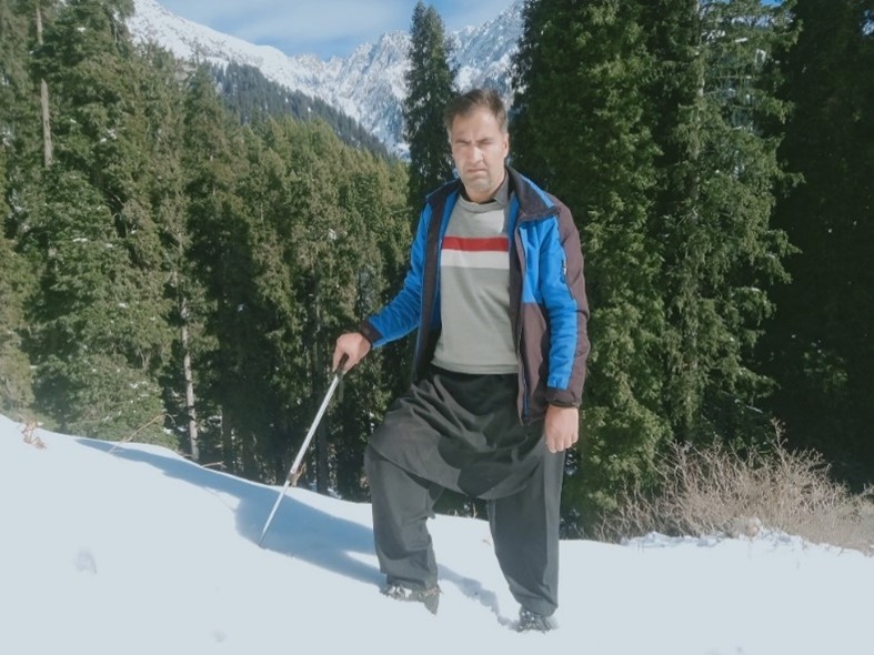
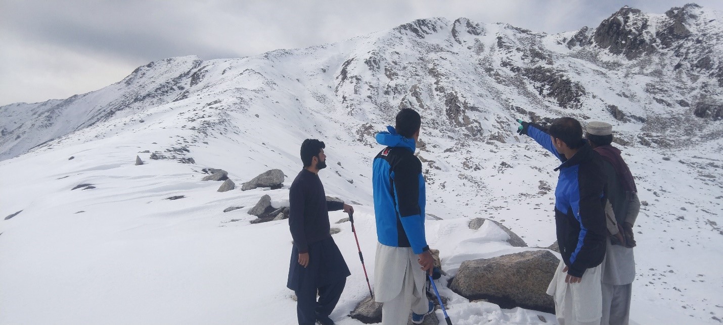
Deploying sensors in extreme weather and hard to access areas was quite challenging. The technology had to be robust enough to work at low temperatures and light enough to be carried to the mountain top while reliable enough to limit maintenance visits. "It is vital to do robust simulation and lab testing before embarking on a field journey," said Mr. Zahoor. He tested the equipment under extreme temperatures and worst-case scenarios before deploying them.
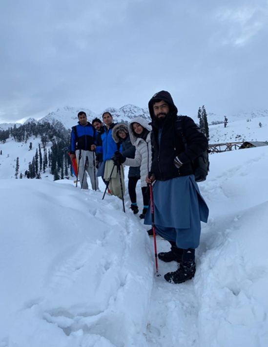
Field deployment at higher altitudes comes with challenges that need careful planning and preparation. Climbing the mountain with weight needs extreme fitness. "I used to run 10-15 km at LUMS before traveling to Swat for deployment to ensure my body supports me during the climb", said Zahoor. The team must foresee worst-case scenarios and plan for medical emergencies and extreme weather. "We always go in teams of 5-7 people to make sure any medical emergency can be sufficiently addressed, and there are enough people to carry the sick to the help", mentioned Zahoor.
Initially, the sensors were deployed at lower altitudes. In 2019 the team deployed sensors at 12,000 feet and another one at 12,800 feet in 2020. The sensing parameters have also been improved. What started as snow level monitoring is now evolved into a complete weather station that measures solar radiation, wind speed, temperature, and
soil moisture levels, which has applications in water resources management research, climate change study, and disaster risk reduction in these little-studied foothills of Upper Indus Basin (UIB). This network of weather stations and stream gauges has predicted seasonal events even when there is no snow. For example, the stream flow gauges installed in the Gabin Gabba valley served an early warning system for flooding in the Kabul River during heavy rains.
One Thing Leads to Another
WIT Director and SSE faculty, Dr. Abubakr Muhammad, put forward an idea to extend the estimation of snow depth for the whole catchment using satellite remote sensing to observe the overall water budget of the valley. The purpose was to validate ground data through the measurement obtained from satellite remote sensing. The idea coincided with the establishment of the NCRA Agricultural Robotics Lab (NARL) at LUMS, in which water efficiency and environmental conservation were set as major goals towards protecting resources for Pakistan’s agriculture.
With this objective in mind, Mr. Muhammad Sohail (research associate, NARL) teamed up with Zahoor’s team to conduct research from 2018 – 2021 on catchment-level seasonal snowpack monitoring, using a combination of remote sensing and in-situ measurements. Previous studies on the cryosphere of the Upper Indus Basin (UIB) have mostly focused on glaciology and have either used remote sensing tools or sparsely deployed ground station networks at the regional or basin scales. Mr. Sohail also a native of Swat, used both his knowledge of the region and his training in remote sensing (from IST, Islamabad) to work on this challenging application.
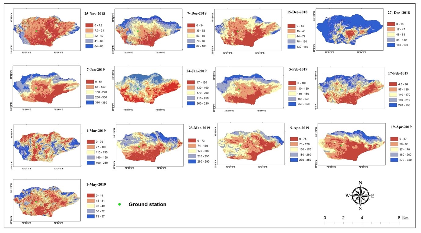
To estimate the snow depth at the catchment level, Sohail’s team has processed Sentinel-1A (C-Band) data and validated WIT’s estimates by an indigenously developed ground-based monitoring station. He has used differential interferometry for the inversion of spatial snow depth from November 2018 to May 2019. The results indicate a spatial maximum of 350 cm snow depth within the catchment and a temporal maximum of 216 cm at the validation point. The relative error (RE) with respect to the ground station was estimated to be 90% and an RSME of 3.0cm for the mean snow depth range up to 229cm. The good performance of TOPS data with spatial-temporal baselines and inexpensive in-situ validation offers significant potential in future applications of snowpack monitoring and water resources management studies in the Upper Indus Basin of Pakistan.
This work is being submitted for review at a top journal on the remote sensing of environmental systems. Sohail and Zahoor’s work further shows the great potential for extending these scientific tools to other catchments and watersheds in the regions. It also demonstrates the impact highly trained and motivated scientists and engineers can bring to their local communities.
Bringing Global Expertise to Local Problems
The WIT team working on snowpack received a major boost and international recognition with the arrival of a postdoctoral researcher in 2021. Dr. Jawairia Ahmad joined the team after receiving her PhD in Civil Engineering from the Department of Civil and Environmental Engineering, University of Maryland, College Park, USA. Her doctoral dissertation was focused on improving terrestrial water budget estimation across high mountain Asia and the adjoining region. Her research interests include the utilization of machine learning and data assimilation in Earth science.
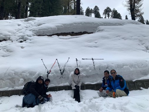
Dr Jawairia’s arrival has triggered many international linkages to boost WIT’s initiatives related to snowpack and research in the high mountain HKH region. She has competitively won a CLiC fellowship which will allow her to perform field work in Switzerland and Pakistan. The WSL Institute for Snow and Avalanche Research SLF has developed several useful tools to study snow in mountainous terrain such as the Alps. Considering the similarities in the topography, it is expected that these models would benefit the study of snow across the Karakorum mountains. Thus, SNOWPACK and Alpine3D models will be used to spatiotemporally model the snow across northern Pakistan using the in-situ collected data. The overall idea therefore is to use Dr Jawairia’s working knowledge of global datasets to study smaller-scale systems in extreme detail using satellite data, computer models and field work. Two sites have been selected for field measurements. The first site is Gabin Jabba (average elevation 2582 m.a.s.l.) where WIT snow depth and streamflow measuring sensors are already installed and are monitored by affiliated team members residing there. Secondly, Skardu (2228 m.a.s.l.) where seasonal snow persists for a longer period and where WIT faculty including Dr Jawairia and Dr Abubakr intend to forge a major curricular partnership on water resource management with the University of Baltistan. Prior to the fieldwork, the topology, vegetation, and satellite-based seasonal snow patterns will be analysed to select the most suitable transect along which snowpits will be dug.
A team lead by Dr. Jawairia travelled to the proposed sites and collected in- situ snowpack data along the planned transect. Snowpack characteristics such as snow depth, snow density, snow grain size, ice layers, snow hardness, and temperature was measured.
The collected measurements are to be digitized and quality checked prior to storage in standard geographic data formats. The collected measurements will then be visualized and analysed to discern any apparent spatial patterns in snowfall due to complex topography and forest vegetation.
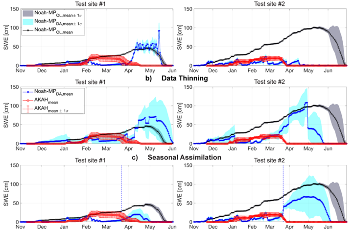
The spatiotemporally modelled estimates derived from these field measurements will be evaluated using the snow depth data collected by the currently installed WIT sensors and the independently collected AKAH measurements of snow depth (wherever available). Also, independent satellite-based retrievals and data assimilated estimates will be compared with the in-situ measurement-based model output (SNOWPACK and Alpine3D estimates) toa characterize biases in satellite retrievals across the Karakoram mountains.
Data Dissemination
The collected and modelled datasets are available for public usage on WIT’s website
Conclusion
In conclusion, science is a highly interdisciplinary and complex enterprise that thrives on creativity. A few years back, no one would have thought LUMS will have a major research initiative and field presence in the high mountains studying snow. It started with the curiosity of a single research associate, it made progress with the encouragement of a visionary leader, it grew with the addition of experts in new areas, and it is now thriving with the help of local and international partners.